Xiengkhouang Province
Province is a province of Laos, located in the Xiangkhouang Plateau, north-east of the country. Originally known as the Principality of Muang Phuan (Muang Phouan / Xieng Khouang), the present capital of the province is Phonsavan.
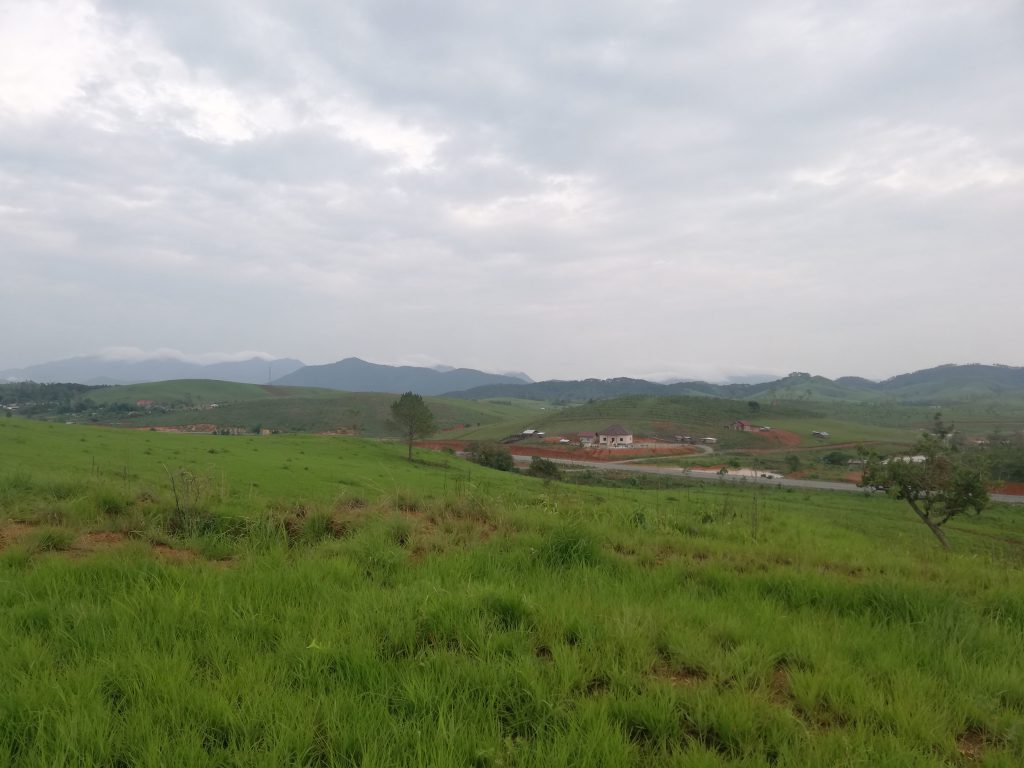
Xiangkhouang Province covers an area of 15,880 square kilometres (6,130 sq mi) and has largely a mountainous topography. The province borders Luang Prabang Province to the northwest, Houaphan Province to the northeast, Vietnam to the east, Bolikhamsai Province to the southeast, and Vientiane Province to the southwest. Apart from floodplains, the largest area of level land in the country is located in the province’s Xiangkhouang Plateau. This area is characterized by rolling hills and grassland. The country’s highest peak, Phou Bia (9,252 feet (2,820 m)), rises at the southern side of the plateau.

Xiangkhouang Province covers an area of 15,880 square kilometres (6,130 sq mi) and has largely a mountainous topography. The province borders Luang Prabang Province to the northwest, Houaphan Province to the northeast, Vietnam to the east, Bolikhamsai Province to the southeast, and Vientiane Province to the southwest. The capital is Phonsavan. Xiangkhouang and Vientiane Provinces are part of the Nam Ngum watershed.[10]
Apart from floodplains, the largest area of level land in the country is located in the province’s Xiangkhouang Plateau. This area is characterized by rolling hills and grassland whose altitude averages 4,250 feet (1,300 m). The country’s highest peak, Phou Bia (9,252 feet (2,820 m)), rises at the southern side of the plateau, while the Plain of Jars is in the plateau’s center.[11]
Nam Et-Phou Louey is the National Biodiversity Conservation Area (NBCA) which covers a total area of 5,959 km2 extends within the Xiangkhouang Province apart from the Huanphan, Lungprabang provinces. The park consists mainly of mountains and hills. The area is the source of many rivers. It is named after the Nam Et River and Phou Louey Mountain (“Forever Mountain”).The area has a high level of biodiversity, and a number of endangered species.
Xiangkhouang Province is one of the main maize producing areas of Laos. It was heavily bombed during the Vietnam War era.
Xieng Khouang Province is one of the country’s provinces that managed to attract a considerable number of investments. In Xieng Khouang Province, almost half (47%) of the total area has been granted for mineral prospecting and exploration. Still, only 4% of the province’s total area (about 50 thousand ha) has been granted for implementation by 90 projects in 22 different products, of which only about 10 percent has already been developed.
Within 90 projects that have been granted to private sectors, 24 projects are in agricultural sector (44,163 ha), 4 projects are in the tree plantation (173 ha) and 62 projects are in the mining sector (5,454 ha).
Two thirds of those projects are Lao investors, with another nearly 20% of those projects being Chinese or Lao-Chinese investments. Despite the province’s proximity to Vietnam, only 7% of all investment projects in Xieng Khouang Province come from Vietnam.
Reference:
- Wikipedia ‘Xiangkhouang’: https://en.wikipedia.org/wiki/Xiangkhouang_Province
- Lao Decide Info ‘Xiengkhouang’: http://bit.ly/2Y2QCxw


