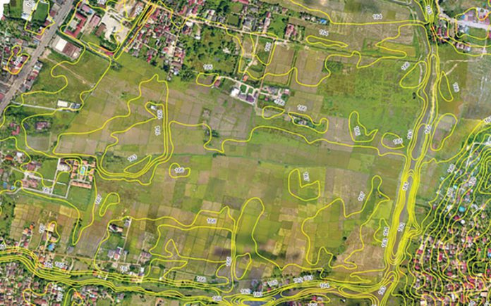
Source from JC Lao/Vientiane Times (paid wall): https://jclao.com/lao-govt-partners-with-hi-tech-company-in-land-surveys/ , dated 14th Sep 2020
The Department of Land under the Ministry of Natural Resources and Environment, and Space Eye Lao Co., Ltd. (Spel) will partner in the study and development of a modern land management system in Laos using digital technology.
The two sides signed a Memorandum of Understanding (MOU) titled Utilising new innovation of survey technology for developing Land Cadastral Mapping, Land Use Planning, and a Land Valuation System” on September 11.
The goal of the project is to facilitate and enhance the effectiveness of land management in Laos.
Director General of the Department of Land, Mr Anongsone Phommachanh, and Spel President Mrs Phoukham Vongvichit signed the MOU, which was witnessed by the Deputy Minister of Natural Resources and Environment, Mr Bounmy Phoutthavong.
Through this cooperation framework, modern technical systems will be used for land surveys and mapping to streamline land registration and issuing of land title deeds. The two parties will facilitate land monitoring and planning, development in ways that are green and sustainable, develop and utilise a modern land valuation system, and make project proposals for assistance from and in cooperation with China.
The Department of Land and Spel will also provide training for personnel working in this field.
A pilot scheme will involve three villages in Vientiane’s Hadxaifong district where new land survey technology will be rolled out for land mapping, planning, and valuation.
Speaking at the MOU signing, Director General of the Land Department Mr Anongsone Phommachanh, said the coming year of cooperation would at least enable the sharing of experiences and would involve the use of new technology, which would lead to the selection of other areas of cooperation.
The department had been working with Spel in recent years on land measurement, use of survey stations, and the maintenance of equipment, he added.
The government plans to complete surveys of 1.7 million plots of land and issue land title deeds for them by 2025.
Also speaking at the signing ceremony, Spel Manager Mr Cheng Xiaoyang said the results would be discussed at the conclusion of the pilot project.
Project participants would decide which of three systems – unmanned aerial vehicle, real time kinematics, or satellite remote sensing – was the most beneficial and would help speed up land surveys and the issuing of title deeds.
According to an expert from Spel, land surveys using an unmanned aerial vehicle provide accuracy in centimetres, while the use of satellite remote sensing gives measurements in metres and so is less accurate.
Space Eye Lao Co., Ltd. was established in 2013 with its headquarters in Vientiane to provide comprehensive global navigation satellite system solution.


